
Geographic Information System
Manage and Analyze Your Electric Power Distribution Systems
Geographical Information System by QEI
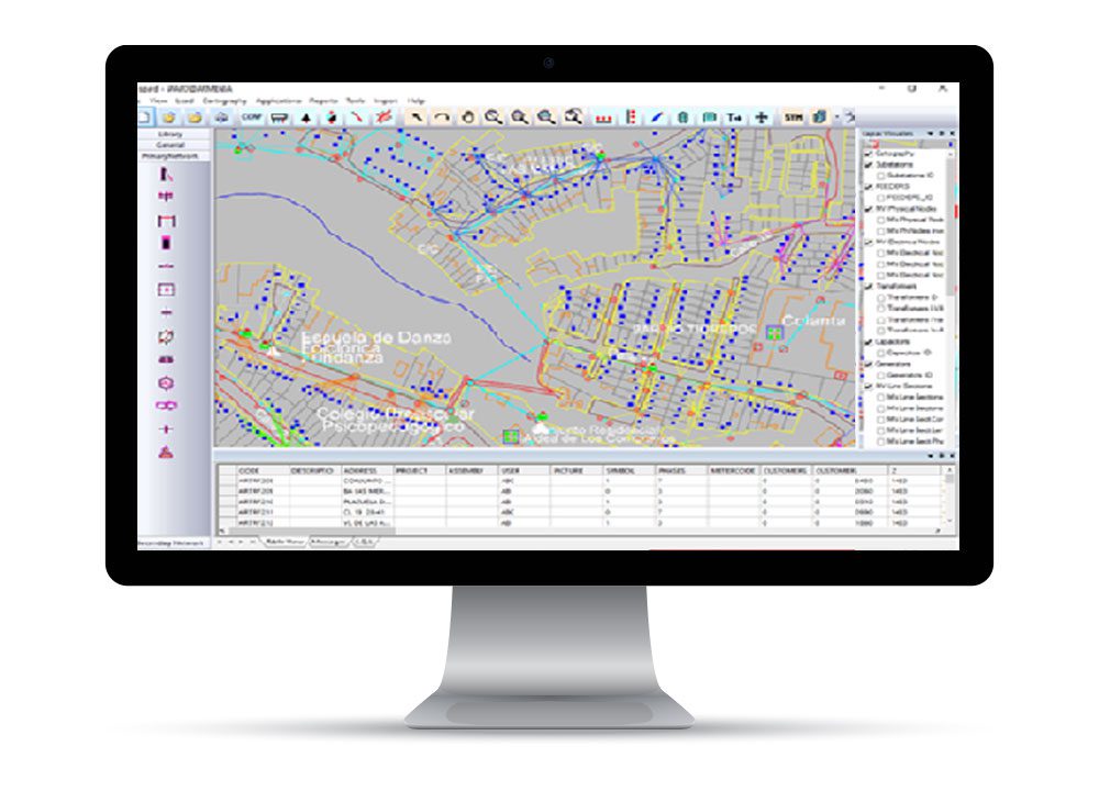
GIS provides geographic and topologic network distribution database management and updates featuring integrated grid analysis.
Let GIS help with the pressures of rapidly changing technology by creating and maintaining accurate and functional location-based models of the facility network to monitor and manage network operations and responses to outages.
GIS is supported by both vertical and horizontal capabilities – such as enterprise mobility, reporting, and analytics – and complementary workflow-based solutions for specific functions from customer relations to physical security.
GIS delivers rich and functional data models and interoperable interfaces needed to support real-time operations, automation, and coordination across systems. This enables operators to develop closer interaction and coordination between the systems, processes and data of network operations, network engineering and customer services – whether in the office or the field.
GIS Benefits:
GIS Features & Functionalities:
What Our Customers Have to Say
“QEI’s mCAP and eCAP capacitor bank controller solutions are well-suited for Vietnam’s power distribution networks. The products not only meet technical requirements but also deliver clear economic benefits by optimizing system operation and reducing power losses. In addition, QEI’s professional support services represent a significant added value, contributing to the overall success of project implementations.”
My Phuong Trading Company Ltd. (MPCO)
“QEI is always making improvements to their product, and it is almost always a result of customer feedback. QEI listens, acts, and highlights the improvements every year at the user conferences. Great job QEI!”
North American Utility
“QEl did a fabulous job installing and configuring four SCADA servers for our Quad-Redundant QEI SCADA system.”
Florida Water Utility
“For over the last 10 years, we have had a QEI SCADA system that monitors our two substations and line reclosers. We have been very happy with the quality of their product and more importantly, the service that they provide to maintain the system. Everyone at QEl really seems to know their product inside and out.”
Village of Lake Placid
“We have utilized QEl for our SCADA needs for over 20 years. They provide an excellent system, both software and hardware. QEl’s staff has alwavs been there for our needs and is always helpful and friendly We highly recommend QEl’s system and their maintenance contracts to keep your system current.”
Emerald Coast Utilities Authority (ECUA)
“The new website is very user-friendly. I really like the Customer Portal, which provides quick access to manuals, presentations, and software updates. Q Tips and more.”
City of Wilson, NC
“We have always been able to rely on QEl for their technical knowledge and support. Thank you QEI.”
Mid-Atlantic Municipal Utility
“QEl is a company that not only makes a great product but backs it up with outstanding service.”
Village of Lake Placid
“It was a pleasure working with the QEI Engineer during the Onsight installations, He was very professional and worked through the few hiccups that we encountered to get the system up and running.”
Controls & Communications Engineer at Easley Combined Utilities
It’s Easy to Get Started
STEP 1:
Schedule a Consultation Call
Let’s talk through your goals and what your current infrastructure looks like.
STEP 2:
We’ll Collaborate to Develop a Solution
We’ll develop a plan to modernize your infrastructure to meet your goals.
STEP 3:
Experience the Advantages of QEI
We’ll coordinate and execute the plans for your upgraded system.

 English
  Spanish